 > ENC Master > Climate Encyclopaedia > Weather > basics > 1. Weather & Fronts > * Worksheet 2
 |
|
|
|
|
|
|
|
WeatherBasics |

Worksheet: Warm and cold frontsSheet 2: Satellite view of a cold front |
|
.
|
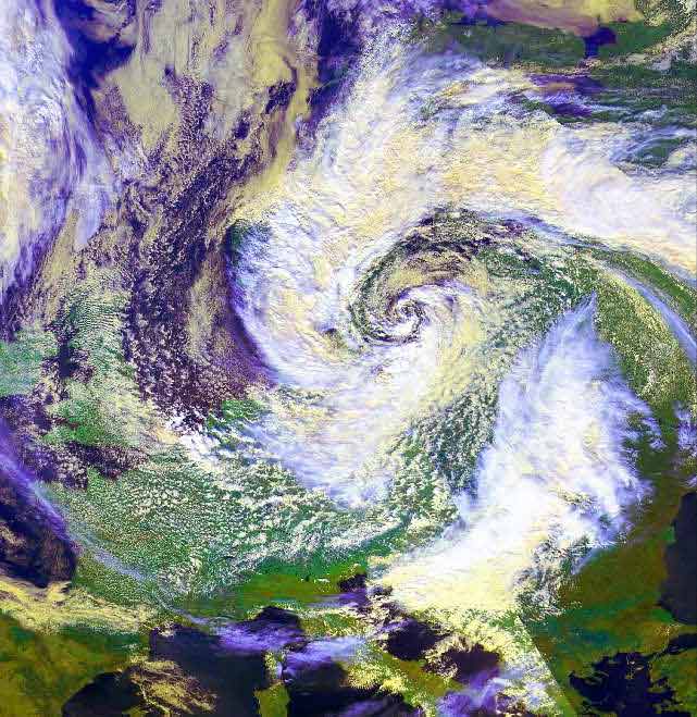
Excercise:This satellite picture shows a cold front above Central Europe.
and draw the bow of the Alps, the Po delta , and the border with extreme weather appearances in the picture!
|
|
Impressive swirl-structure of a strong cyclone with its center above the East European Sea.
above Northwest, Middle and East Europe into the center of the cyclone The plain of the Po delta, in the lee-side of the Alps, is almost free of clouds. Further eastwards a broad, bright band of clouds marks the border to continental warm air above southeast Europe; at this border extreme weather appearances are normal.
|
About this page:- Author: Dr. Yvonne Schleicher - University of Nürnberg - Germany
|