|
|
 |
|
|
|
|
| |
|
|
|
Clouds & Particles
Basics |
The different types of clouds in the atmosphere
Clouds are classified into a system that uses Latin words to describe their appearance and the height of cloud base. This classification is due to the English chemist Luke Howard in 1803. The Latin words used are: cirrus, that means "curl of hair"; stratus, that means "layer"; cumulus :"heap"; and nimbus: "rain".
|
|
|
|
|
|
|
Cloud types are divided in 4 groups. The first three groups of clouds are identified based upon the height of cloud base above the ground:
- high level clouds, from 5 to 13 km
- mid-level clouds, from 2 to 6 km
- low level clouds, from 0 to 2 km above the ground
The fourth group consists of vertically developed clouds: such clouds are so thick that they cannot be classified according to their level above the ground. |
High level clouds
High level clouds are named cirrus, cirrostratus and cirrocumulus. They are so high in the sky that they are made of millions of tiny ice crystals, rather than water droplets found at lower altitude. Indeed, their temperature is less than -40°C! |
 |
|
|
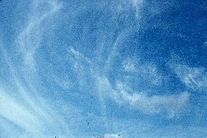
1. Cirrus cloud
Source: JF Gayet, LAMP.
|
|
|
Cirrus (Ci)
Cirrus clouds are curly, featherlike and will often be the first clouds to appear in a clear, blue sky. Shape and moving of cirrus clouds can be an indication of strength and direction of high altitude winds.
Such clouds never produce rain or snow at the surface. |
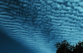
Cirrocumulus (Cc)
They take the form of small white balls that are individual or in long rows, high in the sky. When the puffs are in rows, they give the cloud a rippling appearance that resemble the scales of a fish and distinguishes it from a Cirrus or a Cirrostratus.
|
|
 |
|
|
2. Cirrocumulus. Source: NOAA.
|
|
 |
|
|
3. Source: J. Gourdeau.
|
|
|
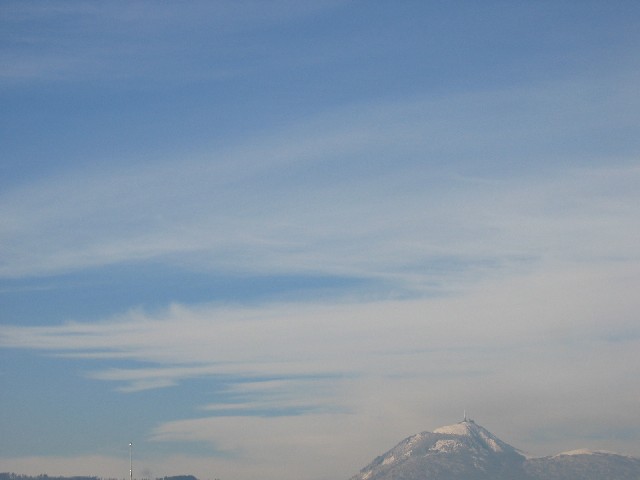
Cirrostratus (Cs)
These sheet-like, nearly transparent clouds form above 6 km. Cirrostratus clouds are so thin that the sun and moon can be seen clearly through the cloud. When sun or moonlight passes through the ice crystals of a cirrostratus cloud, the light is bent in such a way that a halo may form. Cirrostratus clouds often signal an approaching precipitation event. |
Mid-level clouds
Such clouds with the prefix "alto" have bases between 2 to 6 km and are named Altostratus and Altocumulus. |
 |
|
4. Altostratus
Source: NOAA |
|
|
 |
|
5. Altocumulus
Source: NOAA |
|
|
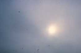
Altostratus (As):
Altostratus clouds are composed of water droplets and ice crystals. They cover the entire sky over an area that usually extends over hundreds of square kilometres. Sun appears as if behind frosted glass : dont look for your shadow on the ground, you wont find it ! And do not forget your umbrella
Although altostratus clouds bring very little precipitation, they often indicate increasing and likelihood of precipitation. |
|
Altocumulus (Ac):
These clouds are white, grey, or both white and grey, they are puffy or like fuzzy bubbles in long rows. They generally have dark, shadowed undersides. Altocumulus without shading may sometimes be confused with cirrocumulus. In case of doubt, hold your hand at arms length: if the puff is smaller than one finger width, you are looking at a cirrocumulus cloud! |
Low level clouds
Between the ground and 2000 m height, clouds are most generally composed of water droplets and are called stratus, stratocumulus and nimbostratus.
Stratus (St):
Stratus clouds form a low layer that cover the sky like a blanket. They develop horizontally as opposed to the vertically developed cumulus cloud. They can form only a few meters above the ground. Moreover, a stratus cloud at the ground level is nothing else than fog ! |
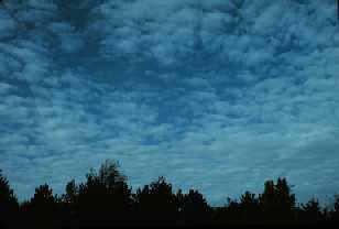
Stratocumulus (Sc) :
They are grey with dark shading and spread in a puffy layer. They do not produce rain. They often form after a rainstorm.
|
|
 |
|
|
6. Source: JM Pichon, Laboratoire de Météorologie Physique
|
|
 |
|
|
7. Nimbostratus. Source: J. Gourdeau.
|
|
|
Nimbostratus (Ns) :
Such clouds form a dark grey, wet looking cloudy layer, associated with falling rain or snow. They can also be considered as mid-level clouds as their thickness can be of about 3000 m! They totally mask the sun. |
Vertically developed clouds: cumulus and cumulonimbus |
Cumulus (Cu)
Cumulus clouds look like white balls of cotton wool. They are usually isolated with blue sky between the clouds, and they sometimes have funny forms. As they are due to thermal convection (see the chapter "formation processes"), they have flat bases and lumpy tops.
|
|
 |
|
|
8. Source: JM Pichon, Laboratoire de Météorologie Physique
|
|
|
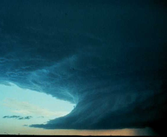
Cumulonimbus (Cb):
Here is the king of clouds. The top of such a cloud can reach 12 km (much higher than the Everest!) and is commonly topped with anvil-shaped head. Rarely, cumulonimbus clouds can reach altitudes up to 18 km and penetrate into the stratosphere. Lower level of cumulonimbus is made mostly of water droplets, whereas at higher elevation, ice crystals dominate as the temperature is well below 0°C. Vertical winds inside the clouds can reach more than 100 km/h. If you like rain, thunder, lightning and even tornadoes, cumulonimbus are your friends! If not, just run quickly to your house! |
 |
|
9. Cumulonimbus clouds. You can see it is anvil-shaped, and that it's raining under it.
Source: NOAA |
|
|
 |
|
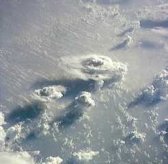
10. Cumulonimbus clouds from the space.
Source: NASA |
|
About this page...
Author: Justine Gourdeau - LaMP Clermont Ferrand/ France
Date of generation: 2003-06-03
1srt reviewer: J. Feichter, MPI for Meteorology, Hamburg. |
|
|
|