|
|
 |
Now let’s find out what El Niño does to this normal situation
(see worksheet 1 and 2).
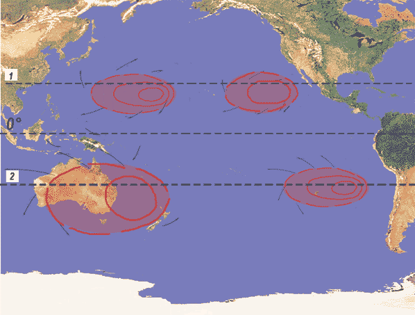
Every now and then the pressure pattern changes:
In South East Asia (western Pacific) a slight High dominates instead of the Low Pressure area, and the High Pressure area over the Easter Islands diminuishes. This smaller contrast between pressure areas then causes the trade winds to lessen their force.
|
 |
 |
|
The Pacific, pressure system, and ocean currents, El Niño conditions
map by design agency "Zur Gestaltung-Nürnberg", modified by Julia Heres
|
|
Also, as the trade winds become weaker, they do not push the cold water of the Humboldt stream from South America into a westerly direction.
Watch this animation to see the Walker circulation under the influence of El Nino:
|
Weather under El Nino influence, animation and design by Julia Heres |
|
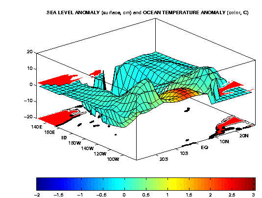
And if you want to see it more dramatically, click onto this picture to see a 3D-Simulation:
(Attention: As the animation has a size of 870 kb it may take a little while to load!)
|
 |
 |
|
Sea level anomaly and temperature anomaly, source of animation and picture: http://www.cdc.noaa.gov/~jjb/animlg1.gif
|
|
Exercise:
Can you bring the two figures together? (cross section vs 3-dimensional animation)
Describe where you can find the equator in the 3-dimensional animation.
Describe the content of this animation.
|
About this page:
- Author: Dr. Schrettenbrunner - University of Nürnberg - Germany
- scientific reviewing:
- educational reviewing: Dr. Yvonne Schleicher , Julia Heres
- last update: 09.09.03
|
|
 |
|


