|
|
 |
|
|
|
|
| |
|
|
|
Lower Atmosphere
Read more |
Worksheet 3
Global vegetation fire map and Statistics on forest fires in Europe (1985 - 1997)
|
|
|
|
|
|
1. Global Web Fire Map
Visit the website you find under this adress:
 maps.geog.umd.edu maps.geog.umd.edu
Click on GLOBAL - GLOBAL and then make a selektion. Click on OPEN MAP and it shows you the latest Gobal Web Fire Map!
Please note: Long loading!
Exercise 1:
Zoom in the sector, which shows you Europe and write down all places, where forest fires are at the moment!
Exercise 2:
Choose a country or a region and search the web for newspaper articles on this topic! What are the main reasons for the forest fires? Write down what you can find out!
2. Statistics & Maps on forest fires in Europe (1985-1997)
|
|
Statistics and maps on forest fires in Europe (1985 - 1997) |
|
Country |
size of fire area in ha/year |
fire area in total in ha |
number of forest fires |
time till the extinguishing began (in min) |
duration of forest fires (in min) |
|
Spain |
207935 |
2703160 |
197957 |
32 |
204 |
|
France |
25390 |
330071 |
52878 |
20 |
235 |
|
Greece |
63335 |
823364 |
21009 |
38 |
817 |
|
Italy |
94412 |
1321781 |
127357 |
43 |
385 |
|
Portugal |
87853 |
1229951 |
193862 |
11 |
274 |
[based on data from: http://europa.eu.int/comm/agriculture/fore/fires/scif/bilan_de.htm]
|
|
Exercise 3:
Read the table carefully and have a close look on the maps.
Then write an essay on forest fires in Europe.
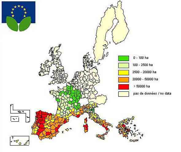
Map 1: size of fire area in ha/year
|
|
|
 |
|
|
[Size of fire area in ha/year; © Europäische Gemeinschaften, 1995-2003; image source: http://europa.eu.int/comm/agriculture/fore/fires/scif/bilan_de.htm]
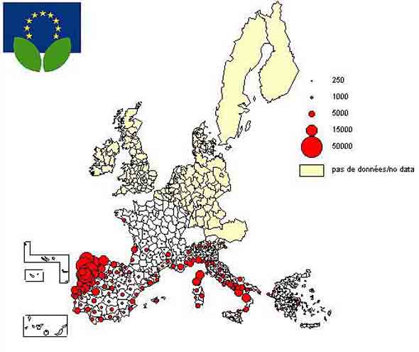
Map 2: Number of fires in Europe (1986-97)
|
|
|
|
 |
|
|
Number of fires in Europe (1986-97); © Europäische Gemeinschaften, 1995-2003; image source: http://europa.eu.int/comm/agriculture/fore/fires/scif/bilan_de.htm
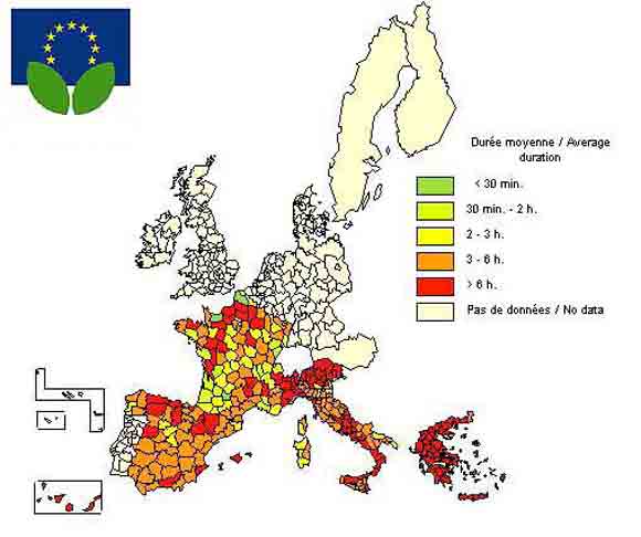
Map 3: Duration of fires in minutes
|
|
|
|
 |
|
|
Duration of Fires in Minutes, © Europäische Gemeinschaften, 1995-2003; image source: http://europa.eu.int/comm/agriculture/fore/fires/scif/bilan_de.htm
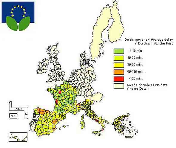
Map 4: Time till the extinguishing of fire began (in minutes)
|
|
|
|
 |
|
|
Time till Extinguishing began (in minutes); © Europäische Gemeinschaften, 1995-2003; image source: http://europa.eu.int/comm/agriculture/fore/fires/scif/bilan_de.htm
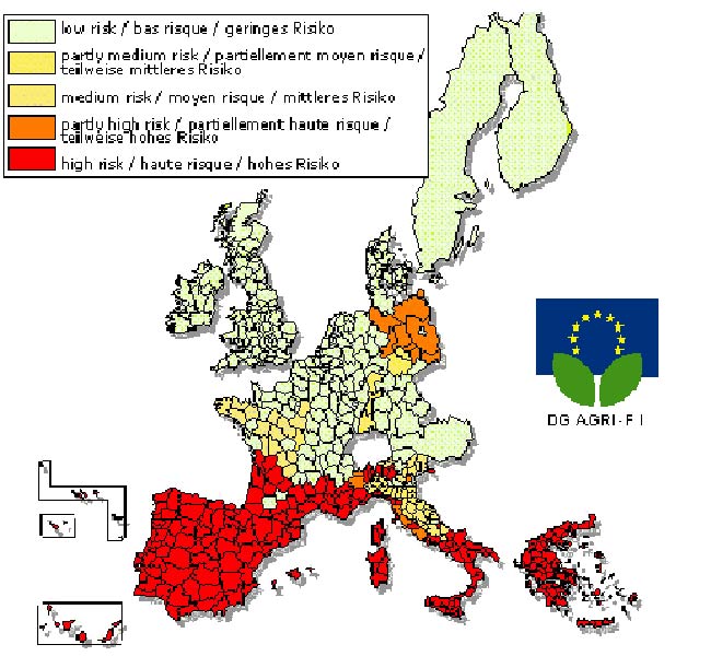
Map 5: Risk of forest fires
|
|
|
|
 |
|
|
Risk of forest fires; © Europäische Gemeinschaften, 1995-2003; image source: http://europa.eu.int/comm/agriculture/fore/fires/scif/bilan_de.htm
|
|
|
|
About this page:
- Author: Dr. Schleicher - University of Nürnberg - Germany
- 1. scientific reviewing: Dr. Jörg Trentmann, University of Washington, Seattle - 2004-01-27
- 2. scientific reviewer: Dr. Rolf Sander - Max Planck Institute for Chemistry, Mainz - 2004-05-18
- educational reviewing: Dr. Schrettenbrunner / J. Heres
- last update: 2004-02-17 |
|
|
|